Philippines
The Philippines , officially known as the Republic of the Philippines, is a sovereign island country in Southeast Asia situated in the western Pacific Ocean. To its north across the Luzon Strait lies Taiwan; west across the South China Sea sits Vietnam; southwest is the island of Borneo across the Sulu Sea, and to the south the Celebes Sea separates it from other islands of Indonesia; while to the east it is bounded by the Philippine Sea and the island-nation of Palau. Its location on the Pacific Ring of Fire and close to the equator make the Philippines prone to earthquakes and typhoons, but also endows it with abundant natural resources and some of the world's greatest biodiversity.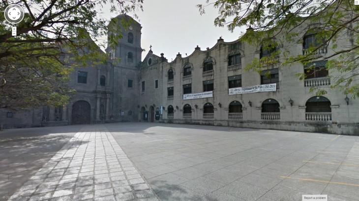
பூமி நடுக்கங்கள், எரிமலை வெடிப்புக்களுக்கு பெயர் போன ஆசியாவின் எல்லையில் உள்ள பிலிப்பைன்ஸ் street view க்கான அறிவிப்பு நேற்று Google Asia official blog மூலம் அறிவிக்கப்பட்டது. 7,107 தீவுகளை கொண்ட பிலிப்பைன்ஸ் நாட்டில் இனி நீங்களும் நடத்து சென்று சுற்றி பார்க்கும் உணர்வை பெறலாம்.
இதன் முதல் கட்டமாக The San Agustin Church, Baluarte de San Diego, Plaza San Luis Complex மற்றும் Fort Santiago ஆகிய வரலாற்று சிறப்பிடங்களின் தொகுப்புகள் வெளியாகி உள்ளன. விரைவில் உள்ளக மற்றும் தெருக்களை உள்ளடக்கிய காட்சிகள் வெளியாகும் என அறிவித்துள்ளனர். நீங்களும் வழமையான கணணிக்கல்லூரியின் சிறப்பு HTML5 Street view மூலம் கீழே சுற்றிப்பாருங்கள்.